Manon's Snowmobile Adventures At The Covered Bridges Of Ferme-Rouge

Today we are going to Lac-des-Iles.
Departure from Mont-Laurier on the Trans-Quebec trail # 63, the old railroad line of the P’tit Train du Nord in direction of Rivière-Rouge. The track is beautiful and pleasant to drive. It’s a track with smooth curves, which I like. The crossing of the village of Val-Barrette is done at 30 km/hour because we cross in the center of the village. Be careful, maybe you will see some deer on the outskirts, if not in the trail.
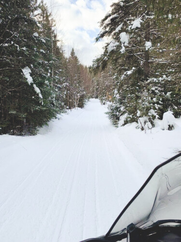
Towards Guénette, the trail takes a gentle but rather sharp curve, nicknamed “the horseshoe”, which gives us a beautiful view from its lookout installed in its center. After this big curve, we will take the Trans-Quebec trail # 53 towards Kiamika. Nice wide track with beautiful landscapes.
We arrive at the village of Kiamika. The trail takes us just outside the village, through farmland. It is possible to stop for gas or a bite to eat at the village snack bar.
I understand that it can be tempting to go for a ride in the crazy snow outside the trail but, you know, those access rights are fragile and can be taken away at any time. Thank you for respecting the property of those who want to let us pass on their land.
Once through the village, we cross a bridge over the Kiamika River to take local trail # 224. This trail sometimes passes through the forest, sometimes on the side of the road. A nice surprise awaits us on this trail: the crossing of the two covered bridges of Ferme-Rouge that take us across the Lièvre River.
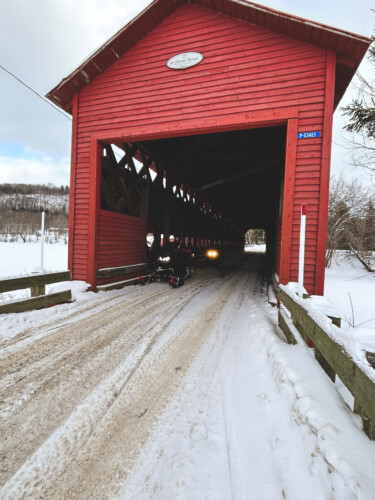
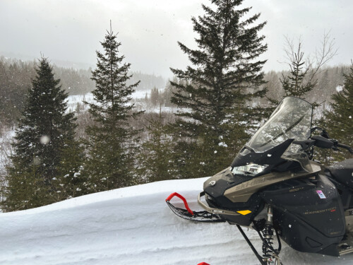
These bridges, built in 1903, have a total length of nearly 132 meters and are the only ones still in use in Quebec. After the bridges, the trail leads us to Lac-des-Iles. After crossing route 309 and a few small streets, we arrive on Lac-des-îles. WOW! This lake is huge ! 10 kilometers long to cross in the center on a well marked track. It’s a good thing it’s well marked, because as it’s almost always windy on the lake, it would otherwise be very difficult to know where to go safely. Be careful, there are often patches of “slush” on the lake. Beautiful houses are located on the shores of this lake and even on some islands! From the lake, in the distance, we can see the Devil’s Mountain with its snowy summit.
As you approach Mont-Laurier, via Trans-Quebec trail #13, you have to cross different streets on a small stretch, cross highway 117, field, forest and a few more streets to return to the city.
I consider it a loop to do even if it is not the most beautiful trail because of the places where you have to pass on the road or in the small residential streets. Who knows, one day it might be possible to have rights of way on land located along the current trail and that would make this section more pleasant…
Total of the hike: about 100 kilometers.
Share on social networks!
Written by : Manon
Published on : 13 March 2023